
All photos taken February 22, 2001 by Sherman Cahal
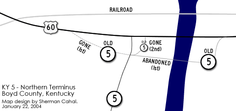
Map of the area drawn by Sherman Cahal.
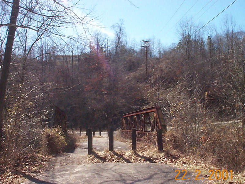
| This is old KY-SR 5's routing. After crossing the bridge, it swung to the left to merge with U.S. 60. The right road is unknown to me. The detioriation is evident in the rutting of the bridge (as seen with the ponding), the rusting of the pony truss, and the overgrowth of vegetation.
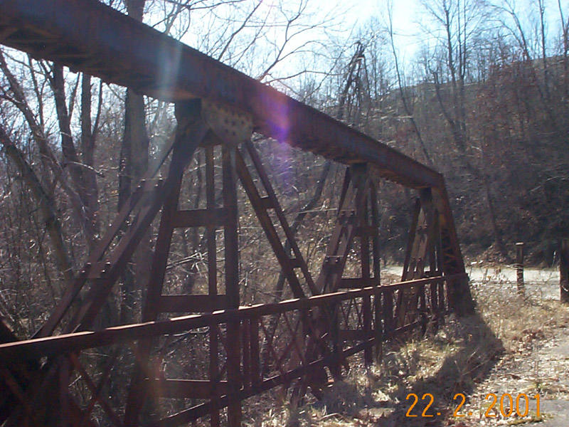
A closer view of the bridge yields a view of grassy pavement and the rusted truss. An inspection of the guardrail reveals that many of the X bars are missing. Lack of upkeep has led to the dismay of this bridge, with the roaddeck decaying.
| 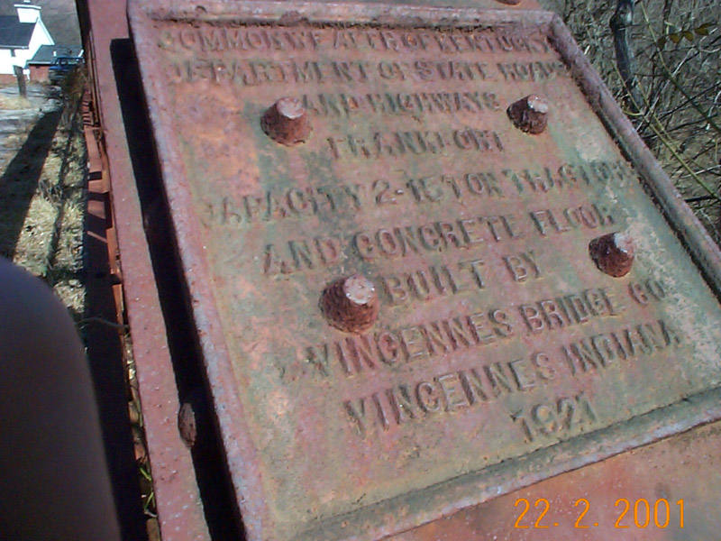
The plaque reads: | * Sherman is not for sure if it is tractors - as he couldn't make it out from the photo, and can't remember what it said the day he was there. 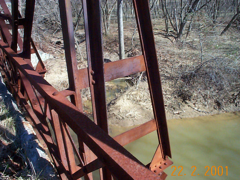
Downward perspective of the rusting truss, and the creek below.
| 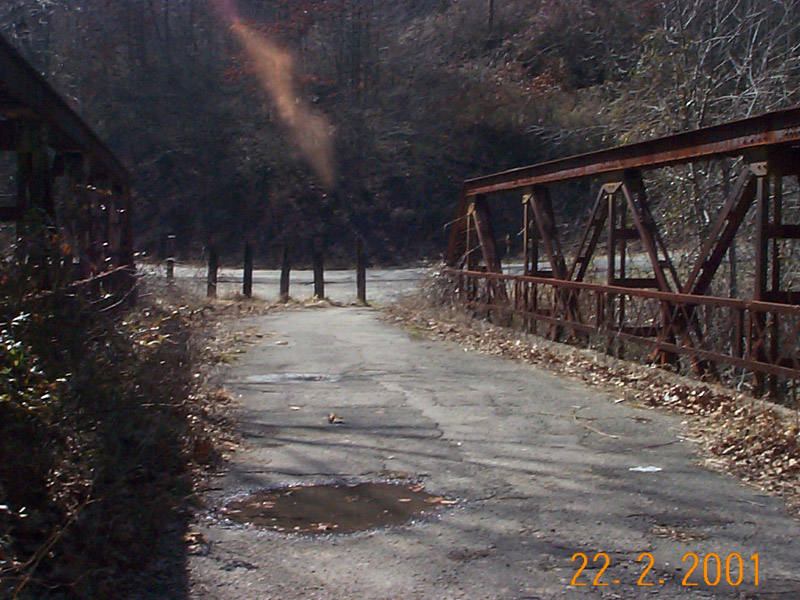
Another shot of the bridge. The top bar of the right side of the bridge is badly rusting, more so than the rest of the bridge structure. Flaky rust is evident. The pavement rutting and heaving is also more prevelent in this photo.
| 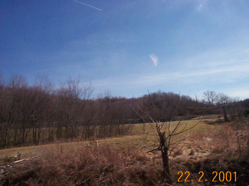
The original KY-SR 5 went across the bridge and hung a left meeting US 60 (alignment #1 in the above map). From this photo, U.S. 60 is dead ahead. When the bridge was abandoned, the roadway went on where the grass now is (alignment #2). The roadway had 2 15 mph curves in the trek to U.S. 60. In 2000, the roadway was once again realigned (current alignment), to remove the sharp curves.
| |
The Lost Highway is copyright © 2005 by Jeffrey Carlyle. All photographers retain rights to their photographs. The Lost Highway was originally developed by Andy Field and Alex Nitzman for AARoads.