
Photos and write-up by Kevin Robokoff late May 2001
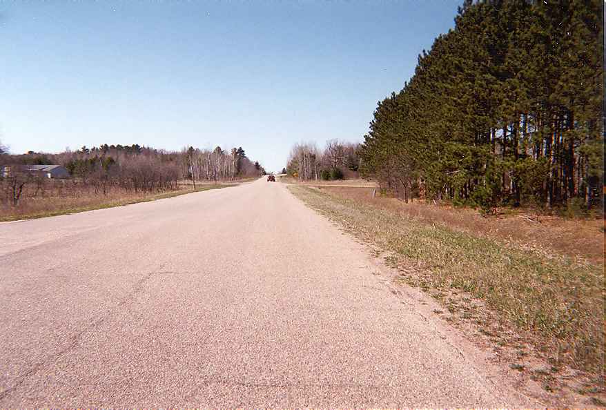
| This is a shot of present Parker Rd. off County DB. This is the US 51 alignment from 1958-1971 with the old concrete underneath the asphalt. This alignment shot off the present freeway and veered to go into Knowlton. We are looking northbound. You can see the wide shoulders present.
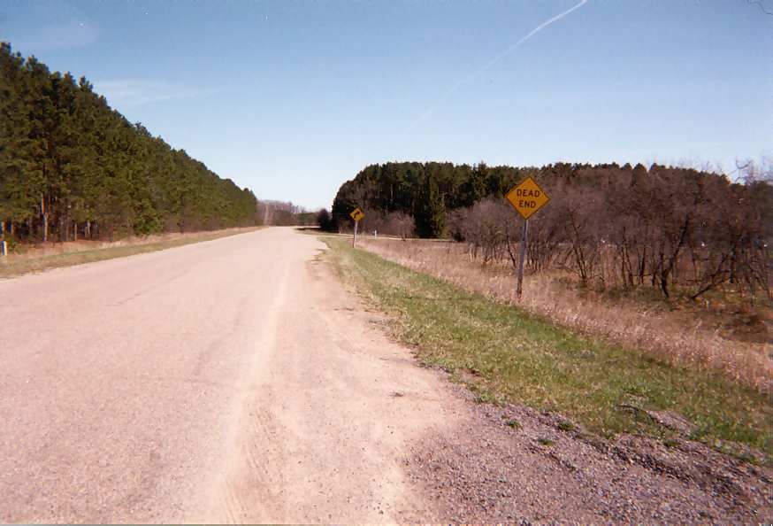
Heres another shot of Parker Rd. facing southbound this time. The road curves and dead ends at a house, but used to curve *into* the freeway alignment. When this road was upgraded as freeway, they bypassed Knowlton. It was the only section they had to realign in 1971 as most of this section between Stevens Point and Wausau was either super 2 or very high grade 2 lane. The geometrics are very good on this section.
| 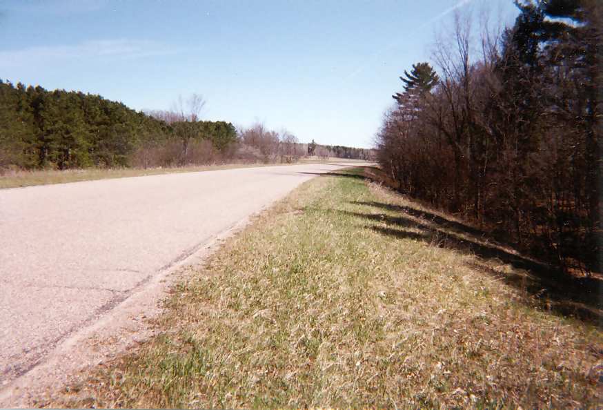
Heres a shot right on the shoulder again facing southbound. There is a boat landing off this road which existed when this was U.S. 51.
| 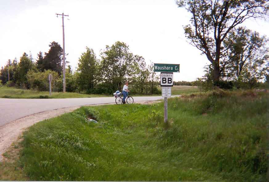
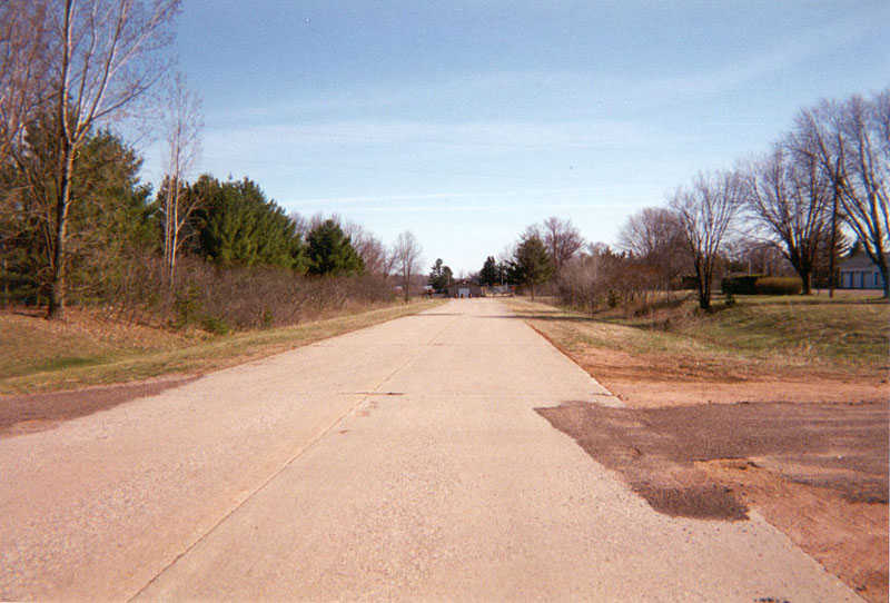
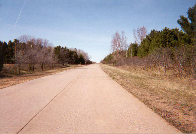
This was taken of old U.S. 51 between Stevens Point and Plainfield WI as the Waushara/Portage County line. It is currently County BB. County BB existed almost where the present freeway alignment is when *THIS* was U.S. 51. They basically swapped places in a sense but the old BB is now a town road that paralells close to the freeway alignment. | This was realigned in the early 1960s, between Point and Plainfield. More abandoned sections of US 51 between Point and Wausau. This section dates before the early 50s I believe, from Point to about 4-5 miles north of Point. Included is old county X going to old 51. As far as I know it was realigned in the early to mid 50s.
| 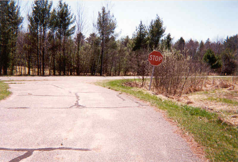
Heres the end of old X coming to old US 51 with a very old wood stop sign here. This old X spurts off present sunset road, a service road created when the freeway was built in 1971. Sunset is NOT old 51!!!!
| 
Heres a shot of old abandonded US 51 northbound. You can see in the distance the freeway of I-39. The road used to have a 90 degree corner or close to it here. I have seen on old topo maps that confirm this.
| 
This pic was taken facing northbound but about 200 feet or so back of the last pic.
| 
This pic shows the barricades at the freeway where this used to have a nasty curve at one time. Part of the present freeway alignment was a super 2 and parts were near or on where old 51 existed pre mid 50s.
| 
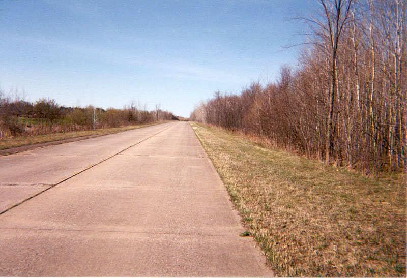
Heres a section of old abandoned 51 from the last set around county X area. We are facing southbound on this section curving toward the present X alignment where this alignemnt disappears into the landscape.
| 
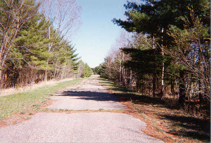
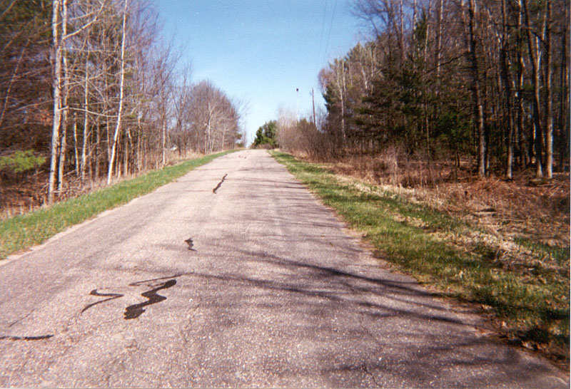
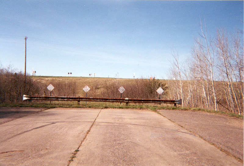
This is an alignment of US 51 north of Knowlton, WI from 1958-71 which was built as a super 2 or highgrade 2 lane road with concrete. This is the only real abandoned section in this area for about 1/2 to 3/4 of a mile. We are facing south coming into Knowlton.
| 
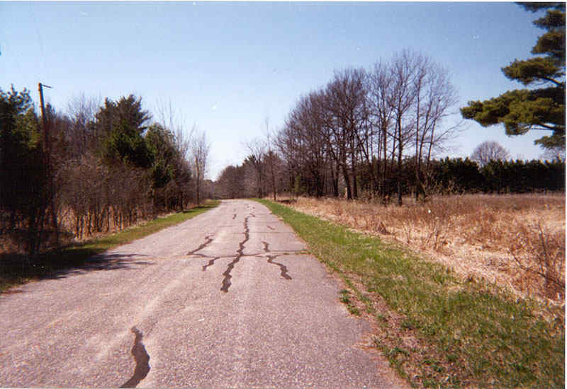
We are now facing northbound on this alignment going out of Knowlton. You can see the pavement is in pretty good shape and yellow and white line markings appear faint on the road. This road is 12 feet wide with 12 foot shoulders and was realigned when they built the freeway to bypass Knowlton. This is on the other side from the first set of photos. County DB is in between these 2 abandoned alignments as DB was U.S. 51 from 1958 to 71 as well.
| 
This view looks north again at the old alignment about 400 feet or so from the last vantagepoint.
| 
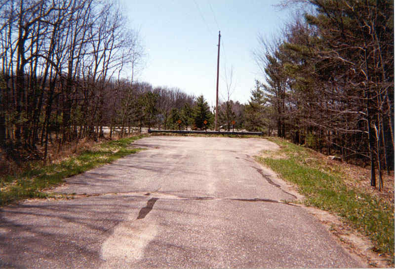
We come to the end of the alignment at the present Wisconsin 34 interchange. Part of the Wisconsin 34 ramp for southbound Interstate 39 is the old 51 alignment. This was obviously built up to form a ramp off of the freeway.
| 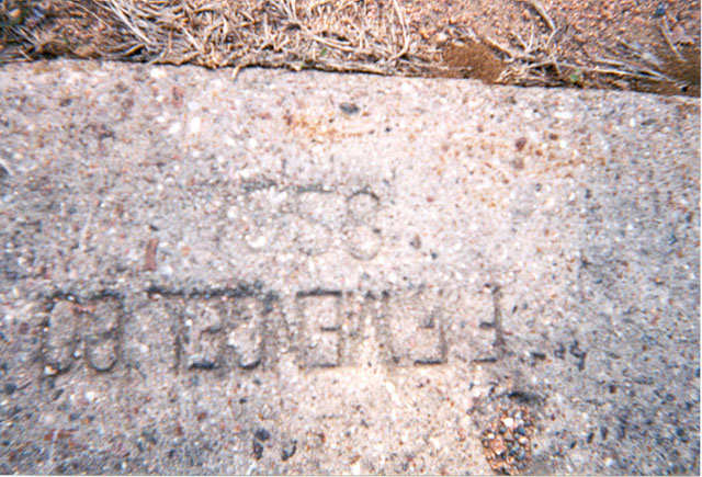
Heres a date imprint in the conrete surface that displays it's completion date of 1958.
| 
Heres a shot of the old 51 alignment taken at the beginning of the abandoned section. The barricade represents Interstate 39 which is located behind me.
| 
Continuing southbound back into Knowlton we come to the old intersection of old U.S. 51 and old WI-34. You can clearly see the old asphalt turn lane here. But unfortunately the signs have long since come down. Old 34 was realigned to bypass Knowlton in 1980. Beforehand, WI-34 was routed onto DB for a short time when U.S. 51 was realigned in 1971. WI-34 used the DB alignment until 1980. | The DB alignment on the north side of Knowlton carries another extremely old 51 alignment that dates back before 1958 and the creation of Lake Du Bay. At that time the Wisconsin River was just a standard river, with no artificial lakes. Photos of the alignment on North 2nd St. and North 2nd Drive between Stevens Point and County X (about 3 miles or so north of Stevens Point).
| 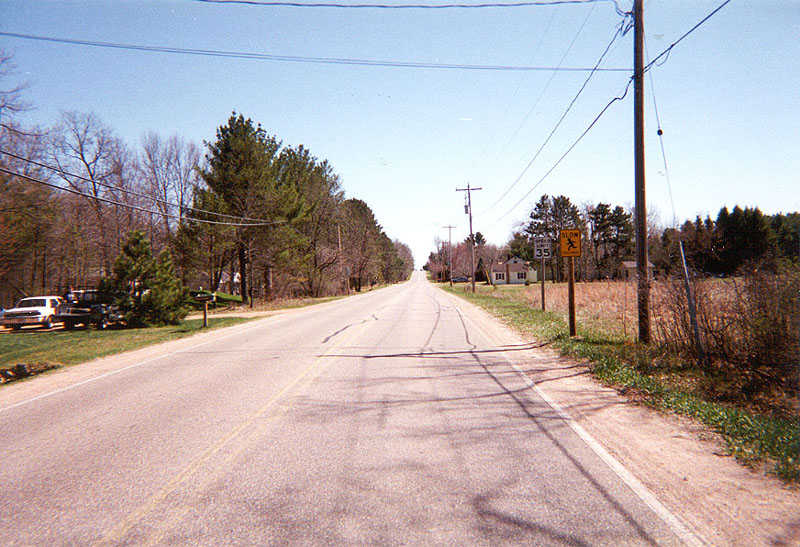
Southbound on current North 2nd Drive about 1.5 miles or so north of Stevens Point. Scenic Jordan Road is to the left behind the camera. This road was resurfaced last year from old U.S. 51 to WI-66 (about 6-7 miles). | Current speed limits on old U.S. 51 is 35 mph due to the presence of residential development. U.S. 51 followed this alignment from it's inception through til the early to mid 1950's. 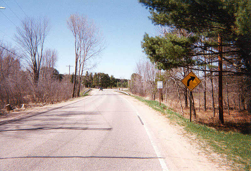
At the same location looking northbound with Jordan Rd. on the right behind the camera. This road was last resurfaced in 1990 or 1991 and is in decent condition, with the exception of faded road striping. Sign on the right displays "Casmier Catholic Church," located off of Casmier Road, which turns to the left. Casmier Road heads back towards the current U.S. 51 freeway, but without local access.
| 
Southbound looking at Casmeir Rd. to the right. The right turn lane was built as part of a construction project occurring around 1990.
| 
Looking north, about 2 to 2 1/2 miles north of Stevens Point, just past the intersection with Casmier Road. A gas station sign toting the advertisement of self service with the ability to pay by credit card is in view (however, this station only contains on pump). Somewhat new housing developments are also present in the area incidating that some economic vitality remains on the old alignment.
| 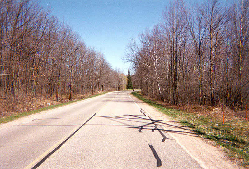
3/4 of a mile north of the previous photo, the highway leaves residential areas while entering a curved section amidst a forest setting. This attractive landscape has lured a few new homeowners to the area.
| 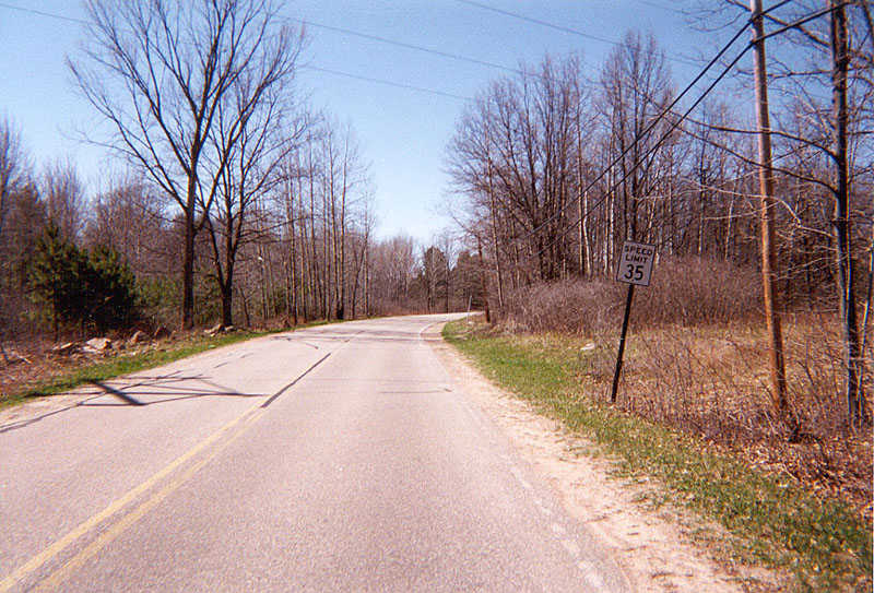
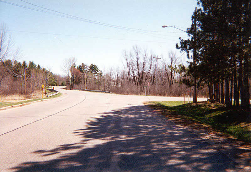
Looking the opposite direction of the above photo facing southbound along the wooded area about 2.5 miles north of Stevens Pt. County X is about 3/4 of a mile to the north, with a 35 mph speed limit remaining in effect.
| 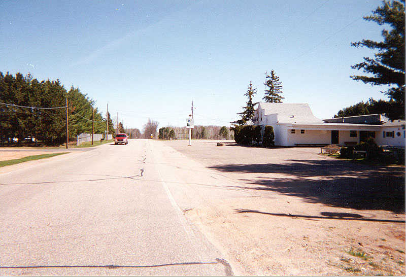
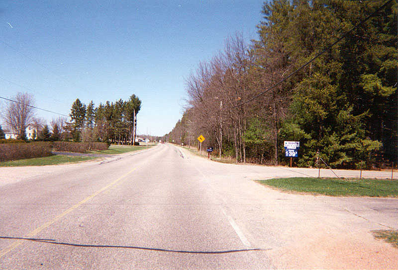
Southbound near the junction with County X with a local bar to the right, about 3 miles north of Stevens Point. The new gas station aforementioned is to the left. Old U.S. 51 veers to the right beyond the bar, but is hard to follow. This because most of the highway has been demolished. Also of note is that this location is the only spot where old U.S. 51 does not follow North 2nd Drive. The wooded area is about 1/4 mile ahead, which was seen in the previous 2 photos.
| 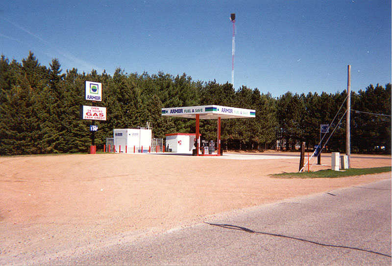
The new Armor Gas station built in 1999. A relay police tower is also visible in the background above the treeline. View looks south off of North 2nd Drive.
| | |||||||||||||||||||||||||
The Lost Highway is copyright © 2005 by Jeffrey Carlyle. All photographers retain rights to their photographs. The Lost Highway was originally developed by Andy Field and Alex Nitzman for AARoads.